Bushmeat Hunting, Protected-Area Gaps, and Village-Scale Wildlife Monitoring
Evidence-based science journalism. Every claim verified against peer-reviewed research.
bushmeatconservationprotected-areaswildlife
Evidence-based science journalism. Every claim verified against peer-reviewed research.
© 2026 Express Love Inc. — All Rights Reserved. Original research-backed content. Unauthorized reproduction, derivative audio/video adaptations, or use for AI training is strictly prohibited without written consent.
Listen to the Soul of this Article (Narrated)
Bushmeat Hunting, Protected-Area Gaps, and Village-Scale Wildlife Monitoring
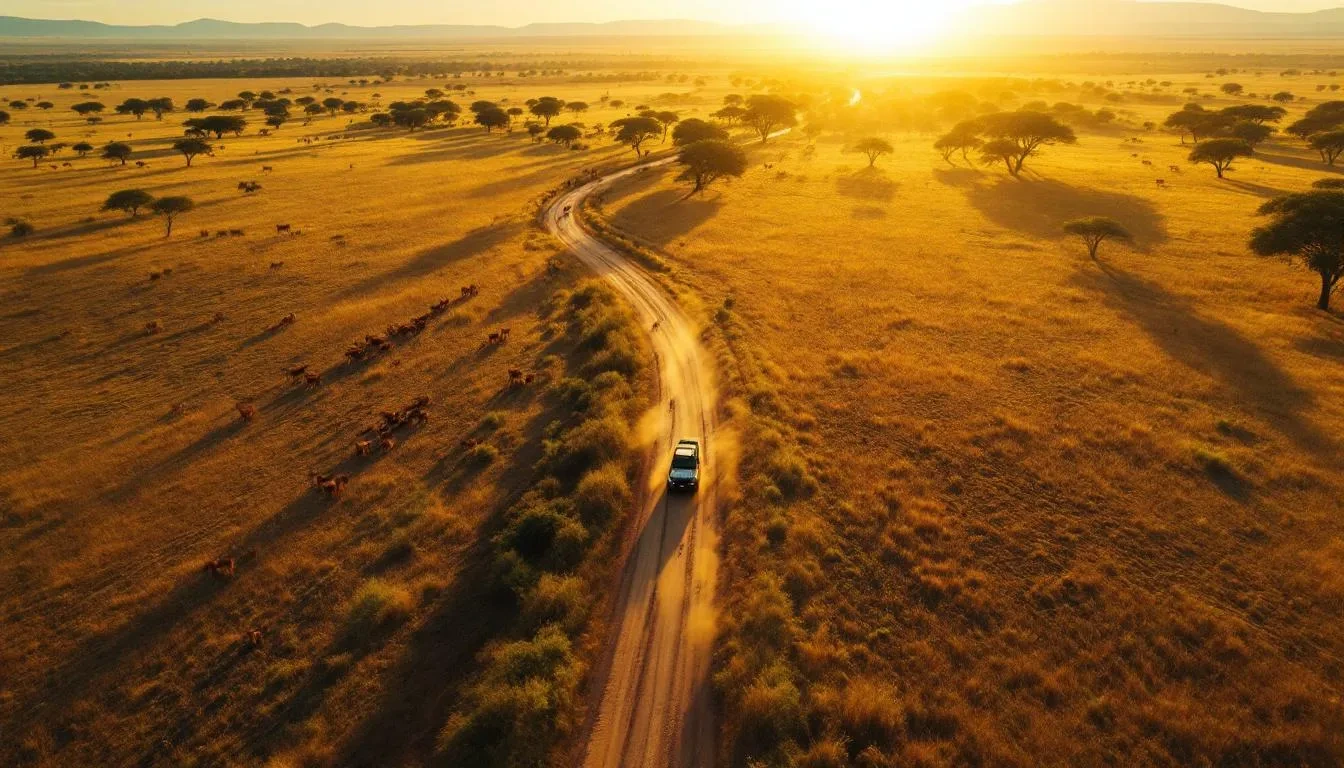
Bushmeat hunting is the extraction of wild vertebrates for protein and income in rural landscapes where enforcement capacity, protected-area boundaries, and threat-mapping resolution often diverge significantly. Kill sites frequently cluster within walking distance of villages, illustrating the direct impact of hunting on local communities. Hunters navigate terrain gradients that global conservation layers rarely resolve at the household scale, leading to a situation where local populations bear the ecological costs of depletion while planners celebrate targets met in low-conflict zones.
Research by Biber et al. (2022) highlights that terrestrial overlays in Conservation Biology indicate underrepresented areas, including those characterized by high temperatures, low precipitation, and varying elevations, relative to global biophysical coverage. Similarly, marine overlays reveal that low and medium sea surface temperature bins and medium to high salinity bins are inadequately covered by the protected-area network. These conditions—arid highlands and warm coastlines—are where human settlements are often concentrated, exacerbating hunting pressure and compounding issues such as water scarcity, crop failure, and protein insecurity.
According to Kuempel et al. (2020), the 2020 Conservation Biology paper integrates spatial threat layers from 2008 and 2013 with Marine Protected Area (MPA) placement data to assess whether protection targets threats that can be mitigated. The study's findings indicate that less than 2% of national-water ecoregions classified as carrying high levels of abatable threats were covered by protection during the analyzed period. Coastal communities that rely on reef fish and marine mammals often find that enforcement resources are directed toward offshore reserves, leaving nearshore extraction activities largely unmonitored.
Global rasters are unable to differentiate between a hunting trail and a logging road. A single 1-km² pixel may encompass a sacred grove, a school garden, and a wire-snare line. When protected area placement prioritizes biophysical representation or political feasibility over effective threat abatement, the consequences include:
Actionable step: This week, overlay your regional protected area shapefile with a 500-meter settlement buffer and a categorical elevation-precipitation raster. Identify any areas that contain more than 10% of the local population yet receive less than 2% of patrol hours. Subsequently, reallocate one mobile team to that underrepresented stratum for a 90-day trial, aiming to enhance both ecological protection and community trust.
Spatial prediction frameworks now replace the outdated assumption that hunters distribute evenly across forests. Instead, friction surfaces quantify how slope, hydrology, and canopy density alter the cost of each kilometer traveled. Brodie and Fragoso tested competing hypotheses about human foraging by pairing known kill locations with landscape resistance layers, revealing which geographical features genuinely constrain effort and which merely appear on maps without behavioral consequence.
Rivers fragment catchment zones rather than accelerate access
Model comparisons demonstrate that waterways function as barriers, not highways. Wide channels lacking bridges force detours or canoe reliance, fragmenting the landscape into discrete hunting zones. A hunter departing at dawn cannot cross a 50-meter river, harvest game, and return before spoilage unless a boat waits at both banks—logistical friction that shrinks effective range more than any slope gradient.
Village proximity outweighs habitat quality in kill-site distribution
The spatial pattern shows concentration near settlements, not in remote high-density game zones. Carrying 20 kilograms of meat across broken terrain for six hours risks spoilage and exhaustion the caloric return diminishes sharply beyond a threshold distance. Even when camera traps confirm abundant ungulates five kilometers deeper into the forest, hunters optimize for round-trip feasibility rather than prey abundance alone.
Slope and understory density impose caloric penalties
Steep ridges and dense vegetation increase energy expenditure per meter, shrinking the hunting radius even when game remains plentiful beyond the first topographic barrier. A 15-degree incline doubles the metabolic cost of ascent thick understory slows travel to one kilometer per hour. These biophysical constraints create predictable halos of high effort within two hours' walk and low effort beyond, regardless of official park boundaries.
Digital infrastructure transforms passive subjects into co-authors
The Reflora Virtual Herbarium integrates specimen records with taxonomic checklists, enabling village monitors to ternal taxonomists. When communities georeference photos of fruiting trees or medicinal bark, they populate the same evidence layers that inform protected-area gap analyses. This architecture converts local knowledge into spatially explicit data streams, ensuring threat maps reflect ground truth rather than satellite assumptions.
Operational translation for this week
Download your region's digital elevation model from USGS Earth Explorer. Calculate slope in degrees using raster analysis tools. Overlay the nearest five village centroids and generate 5-kilometer and 10-kilometer walk-time isochrones—not Euclidean buffers—by weighting each pixel by its terrain resistance. These rings predict where hunting effort peaks and where ranger patrols yield maximum intercepts per shift. Randomize protected-area boundaries against same-sized polygons to test whether current reserves systematically avoid high-threat biophysical bins, then publish the comparison to hold placement decisions accountable to spatial evidence rather than political convenience.
-
*
Bushmeat hunting doesn't follow administrative boundaries—it follows animal movement corridors, seasonal resource availability, and the path of least resistance through landscapes that often lack effective protection. Understanding where hunting pressure concentrates reveals critical gaps in protected-area placement, showing that many reserves miss the migration routes and spillover zones where wildlife faces greatest risk.
Research using spatial modeling of hunter movement patterns has demonstrated that bushmeat extraction intensifies in transition zones between protected areas and human settlements, where enforcement is weakest and animal density remains relatively high. A study combining GPS tracking data with hunter survey records found that up to 70% of harvested wildlife came from buffer zones rather than core reserve areas—not because animals prefer these margins, but because hunters rationally exploit areas where detection risk drops sharply. This creates a landscape-scale extraction pattern that conventional protection strategies fail to address.
The mechanism is straightforward: protected areas are often designed around charismatic megafauna or scenic boundaries rather than the ecological corridors that sustain population connectivity. When reserves sit isolated on a landscape fragmented by agriculture and settlements, wildlife moving between patches becomes temporarily vulnerable, and hunting pressure concentrates predictably at these transition points. Digital herbarium data combined with hunter GPS traces can now map these vulnerability hotspots with precision previously impossible.
This mismatch between where we draw protection lines and where hunting actually occurs has cascading consequences. Small populations in underfunded buffer zones face cumulative pressure that protected-area status alone cannot relieve. Yet this same spatial predictability offers opportunity: communities positioned near these high-pressure zones can become the most effective monitors and stewards, because they witness wildlife movement daily and understand local hunting patterns intimately.
The evidence is mounting that village-scale monitoring networks, strategically placed at landscape gaps identified through movement modeling, can shift bushmeat hunting from an invisible extractive pressure into a measurable, manageable phenomenon. When communities help map where protection fails, enforcement becomes possible—and so does coexistence.
Village-scale monitoring is a participatory surveillance framework that equips local observers with the skills to systematically record wildlife encounters, harvest events, and patrol coverage through standardized protocols. This approach is intricately linked to enforcement and adaptive management feedback loops. Communities situated near high-threat biophysical areas gain three operational advantages when evidence transitions from global protected area (PA) overlays to ground-truthed encounter data.
According to Riisager-Simonsen et al. (2020), marine mammals serve as a pertinent case study for demonstrating the operationalization pathways of indicators within the context of conservation biology and ecosystem-based management. This framework is equally applicable to terrestrial bushmeat species that traverse village boundaries. To effectively address multisector trade-offs, it is essential to integrate environmental, social, and economic knowledge related to shifting fauna distributions (Riisager-Simonsen et al., 2020). This can be translated into three actionable steps:
According to Luhring et al. (2020), body mass serves as a critical mediator that links predator loss to trait dynamics and indirect trophic effects. This is framed within a mechanistic understanding of four trophic levels (2020 Proceedings B parameterization). Gillespie eco-evolutionary modeling provides a simulation of cascades following the loss of top predators while tracking fitness gradients across these trophic levels (Luhring et al., 2020). By employing these four-trophic-level parameter ensembles, informed by the FORAGE database, village councils can visualize the potential consequences of selective hunting of large-bodied frugivores or apex carnivores. This understanding is vital, as it illustrates how such actions can destabilize forest regeneration and pest control. The model serves not as definitive proof of specific intervention outcomes but as a shared visual tool that clarifies previously invisible feedback loops during participatory planning sessions.
Download the standardized patrol-data template from SMART Conservation Software (free, open-source). Train two community members to log GPS waypoints, species sightings, and snare removals during each patrol. Upload this data weekly. After 90 days, compare your encounter density map against the nearest protected-area boundary. If hotspots are identified outside formal protection, petition district authorities to pilot a community-managed zone with co-designed harvest quotas that are aligned with population-level service metrics. Rotate patrol routes monthly using the terrain-aware kernel from section two, ensuring that efforts correspond to actual threat geography rather than mere road convenience.
Here are three ways you can turn this science into practice:
The research is clear. The next step is yours.*
A parking attendant gives people real validation -- heartfelt compliments that transform their entire day. An award-winning short film about the power of seeing others.
Watch on dedicated video page →Experience a heartwarming reminder of the goodness in people as strangers come together to lift each other up. This uplifting video showcases the power of kindness and the beautiful connections that restore our faith in humanity.
Watch on dedicated video page →Timbo the elephant herd leader seeks a century-old jungle elder after a crocodile attack shatters his tusk and triggers a life-threatening infection. Elephants' capacity for collective problem-solving and emotional bonds drives them to travel miles to save one of their own.
Watch on dedicated video page →Peter A. Lindsey
University of Pretoria
NY 10018, USA
The bushmeat trade in African savannas: Impacts, drivers, and possible solutions — Biological Conservation
Adam S. Willcox, PhD
WWF Cameroon
Yaounde, Cameroon
Wildlife hunting practices and bushmeat dynamics of the Banyangi and Mbo people of Southwestern Cameroon — Biological Conservation
David Wilkie
Wildlife Conservation Society
Eating and conserving bushmeat in Africa — African Journal of Ecology
Alejandro Estrada
Janneke Elisabeth van der Laan
Nanditha Krishna
Sharon L. Crowell-Davis
Daniel H. Janzen
More from Animal Conservation
Some studies in specific fish species have documented nociceptors and behavioral responses to noxious stimuli. What these findings prove — and equally important, what they do not — remains the subject of an unresolved structural disagreement in the peer-reviewed literature.

The octopus challenges brain-centric consciousness theories with 500 million neurons distributed across its body.

### Why Love Isn’t Enough: The Physiology of Adoption Trauma You brought your new dog or cat home with a full heart, a soft bed, and the best food you could find. You expected gratitude, or at least relief. Instead,...
Share this article
Bushmeat Hunting, Protected-Area Gaps, and Village-Scale Wildlife Monitoring
Bushmeat hunting is the extraction of wild vertebrates for protein and income in rural landscapes where enforcement capacity, protected-area boundaries, an
8 published papers · click to read
2,577
combined citations
Peter A. Lindsey
University of Pretoria
NY 10018, USAThe bushmeat trade in African savannas: Impacts, drivers, and possible solutions — Biological Conservation
339 citations
Adam S. Willcox, PhD
WWF Cameroon
Yaounde, CameroonWildlife hunting practices and bushmeat dynamics of the Banyangi and Mbo people of Southwestern Cameroon — Biological Conservation
196 citations
David Wilkie
Wildlife Conservation Society
Eating and conserving bushmeat in Africa — African Journal of Ecology
127 citations
Alejandro Estrada
Impending extinction crisis of the world’s primates: Why primates matter
1,451 citations
Janneke Elisabeth van der Laan
Evaluation of hair cortisol as an indicator of long-term stress responses in dogs in an animal shelter and after subsequent adoption
39 citations
Nanditha Krishna
Animal sentience in Indian culture: Colonial and post-colonial changes
25 citations
Sharon L. Crowell-Davis
Social organization in the cat: A modern understanding
276 citations
Daniel H. Janzen
Joining Inventory by Parataxonomists with DNA Barcoding of a Large Complex Tropical Conserved Wildland in Northwestern Costa Rica
124 citations
Researchers identified from peer-reviewed literature indexed in Semantic Scholar · OpenAlex · PubMed. Each card links to the original published paper.